MK Dons v Walsall
I always support the MK Dons whenever I’m at a match in Stadium:MK – and will do so again on Saturday – but I do have to admit a conflict of interest. I grew up in Walsall – and Walsall FC were the first team I went to watch. (15th February 1975 – 5th round of the FA Cup).
MK Dons have had some disappointing results recently – let’s hope they can break out of this on Saturday. For me it would also mark another break. We moved into Walsall back in 1967 – and although I left for University in 1978 my family continued to live there. That ended last week – my mother sold her house and moved into the Hagley Road, Birmingham Extracare Retirement Village. (part of the group which includes Shenley Wood and Lovat Fields). So at last, the ‘conflict of interest’ has ended!!!
Halloween
There’s a lot going on in MK for Halloween this year!
There’s a free evening at the Hub from 4.30 to 7.00pm for kids; their parents; (and those of us who haven’t grown up yet!) – for more details click this link: http://www.thehub-miltonkeynes.co.uk/News-and-events/Events/Halloween-at-The-Hub
Later on (8pm to midnight) there is an evening event at Bar M in the hub – http://www.thehub-miltonkeynes.co.uk/News-and-events/Events/THU-31-OCT—Halloween-Party-at-Bar-M
There’s an party at 360play in Knowlhill – it requires booking, and there is a fee. It runs from 6-8.30pm http://www.360play.co.uk/miltonkeynes/news_and_events/news_detail/13-10-07/Halloween_Party_Fun.aspx
The Slug & Lettuce in the Theatre District has a charity movie and quiz night https://www.facebook.com/events/210626389108882/
On Saturday, the Crauford Arms in Wolverton has a “Zombie Beach Party” http://www.skiddle.com/whats-on/Milton-Keynes/The-Craufurd-Arms/HALLOWEEN-ZOMBIE-BEACH-PARTY-Till-2AM/12020422/#contentjump
If your event isn’t mentioned – do drop me a line at jdavidmorgan@furzton.org.uk and I’ll be happy to share the details with other readers of WestofWatlingStreet.
Furzton Lake
You won’t find Furzton Lake on the old maps of the area – because it was built as part of the development of Milton Keynes. Our planners knew that building upon fields (in which water is absorbed into the soil) can lead to occasional flooding problems. The water runs off houses and roads and reaches streams quickly. Flash floods are more likely. Willen; Caldecotte ; Furzton and the teardrop lakes are designed to slow the rush of water into Milton Keynes’ streams and rivers.
Three streams flowed and met close to the low bridge which takes Watling Street across the valley. Loughton Brook is the main stream flowing through Tattenhoe; Emerson Valley and divides Furzton into South and North Furzton. The lake narrows but extends for some distance upstream. The Brook which rises close to the site of Snelshall Priory and flows through Shenley Brook End is the second stream. Another stream flowed through Howe Park through Emerson Valley.
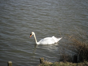
The lake was built during the 1980s. It is now the home to much birdlife – and is popular with walkers; cyclists and anglers.
Bletchley Park – Family Fun Wednesday
This Wednesday (October 30th), Bletchley Park is holding one of its special family fun days for the Half term holidays.
There will be special activities including craft and spy workshops, children’s guided tours, trails, quizzes and handling collections. The fun day is from noon to 5pm.
If you haven’t been before, it’s worth noting that the full admission price (normal admission price applies, under-12s are free), entitles you to an Annual Season Ticket, which is valid for as many visits as you would like during the twelve month period from the time of your first visit. Your admission fee includes complimentary use of the newly-launched Multimedia Guide (in return for a fully-returnable deposit) and an optional one hour outdoor walking guided tour with one of our volunteer tour guides.
Furzton Street Names
Anne Baker brought out a series of books setting out the background to the street names of each ‘estate’ in Milton Keynes. I have the full series at home – and they make very interesting reading.
The two volumes dealing with “West of Watling Street” are Milton Keynes West and Milton Keynes South.
Ms Baker points out that the name Furzton “was taken from the old names of fields which previously covered this area. ‘Furze Ground’ is shown on the Ordnance Survey map 168 and,, with ‘Furze Field’, on a 1771 plan and survey of part of the Lordship of Shenley belonging to John Knapp.
The theme of the street names is “Exmoor” – where there are hamlets, villages and towns called Allerford, Bampton, Barnstaple, Bickleigh, Bilbrook, Brendon, Brushford, Calverleigh, Carhampton,Cheriton, Cloutsham, Combe Martin, Dulverton, Dunster, Elmhurst, Exbridge, Hawkridge, Kingsbridge, Loxbeare, Luccombe, Luxborough, Lynmouth, Marwood, Morebath, Muddiford, Northleigh, Porlock, Selworthy, Shallowford, Shirwell, Simonsbath, Swimbridge, Timberscombe, Treborough, Trentishoe, Twitchen, Washfield, Watchet, and Withycombe.
There are hills in the area called Countisbury, Croydon, Dunkery Beacon, and Winsford
The Number 8 Bus
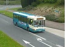
For most of the day the number 8 bus runs every 15 minutes linking Oxley Park; Westcroft; Emerson Valley; Shenley Brook End; Shenley Lodge and Shenley Church End to the railway station; Central Milton Keynes; Campbell Park and on to the District Centre in Kingston and the estates of Woolstone; Middleton;Broughton; Broughton Gate; Brinklow; Wavendon Gate; Old Farm Park and Walnut Tree. It also goes close to Furzton (with the bus stops on Chaffron Way [H7], close to Furzton Roundabout and Fulmer Street [V3] between Egerton Gate and Faraday Drive]).
A PDF map of bus services (which you can zoom in and out) is available here. It shows where the No 8 intersects with other routes – so you can use the number 8 as part of a journey to other parts of the city.
(Click on map to expand)
Weekday Services
The first bus leaves Oxley Park at 05-58 (Fulmer Street 06-13; Milton Keynes Central Station 06-19; CMK the Point 06-27; Kingston 06-38).
Evening Buses leave (for ‘West of Watling Street’) from CMK The Point [Stop L4] at 18-37; 19-07; 19-41; 20-11; 20-41;21-12; 21-42; 22-12; 22-42 and the last bus leaves at 23-12.
They leave the railway station [stop Z2] at 18-43; 19-13; 19-46; 20-16; 20-46;21-17; 21-47; 22-17; 22-47 and the last bus leaves at 23-17.
The full timetable is available at http://www.arrivabus.co.uk/uploadedfiles/Services/South_East/SEMK8_020613_100413.pdf
Bus Services
It is often said that Milton Keynes was designed for the car – and not for buses. It certainly seems that way. The grid system allows speedy crossings for cars between parts of the town – but the bus service is far from ideal. I’d make two points
1 We deserve a better bus service – it is better for the environment; and for our health if more use was made of buses and trains and less of petrol and diesel driven cars. The limited oil remaining in the world would be less quickly used up – and traffic queues would waste less time.
2 While it is far from ideal – individuals can save money – and get around Milton Keynes on the services currently available.
Over the next few weeks this blog will profile the services in the city, with – I hope – useful information to help you get the best out of our buses.
Tomorrow, I will profile the Number 8 Service (from Oxley Park to Wavendon Gate).
A Direct Link to Westminster?
 As noted in the last post, Watling Street ran from the channel ports to Londinium and up through Milton Keynes to Wroxeter and Chester. But was this the original route?
Londinium was, like Milton Keynes, a new city (although it had its roots thousands of years beforehand). By 50AD, according to a notice in the Museum of London, the original road was diverted to take in this developing new city. Where did the original route run?
One of the characteristics of Roman roads was that they are remarkably straight. Unlike the later roads which can be notoriously windy, Roman roads joined up points in a straight line. There are of course abrupt changes of direction to avoid some obstacles.
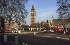
If the road from Dover were continue in a north westerly direction; and the Edgware Road was to follow its path south easterly (rather than abruptly turning eastwards into Oxford Street) they would end up facing each other across the Thames at Westminster.
There has been an oral tradition that the Thames could be crossed by foot at certain times where the Palace of Westminster now stands. Archaeological work (see The royal palace, abbey and town of Westminster on Thorney Island – Museum of London Archaeology Service, 2006) suggests that a sandbank once extended beneath the Palace of Westminster into the then wider & shallower Thames, just to the south of St Stephen’s Chapel (the ‘original’ House of Commons) close to the statue of Richard the Lionheart.
If this thesis is correct we had a direct link to Westminster – via Dunstable; St Albans; the Edgware Road – across Park Lane towards the entrance to Buckingham Palace (the site of Cowford – where the road crossed a branch of the River Tyburn is near to the Victoria Memorial) – across to Tothill Street and along the “ridge” on Thorney Island where Westminster Abbey now stands.
Recommendations
This blog is about that part of Milton Keynes which lies to the west of the V4, “Watling Street”, though I will sometimes post about matters across the city or beyond.
I want to make it clear that although adverts may be added to this blog – they were not added by me – and I do not endorse any of the services or products so advertised. (The price paid for “free” blog – but I hope to put an end to such advertising soon.)
I will happily blog about places – including commercial places such as cafes, pubs, restaurants, places of entertainment – and so on. I want to assure you that I am not constrained by any editor (I am my own editor!) and I do not, and will not accept services or payments for anything I discuss. All you’ll get is my honest opinion. If I’m not happy with something – I will say so: and if I like it – I will also say so honestly.
Watling Street
Watling Street was perhaps the most most important Roman road in England. It ran from the ports in Kent to Londinium (London) to Wroxeter on the border with Wales. Late it became the main route to Ireland – ending at Holyhead. Most of the route is now the A5 (except in the MK area).
In the Borough of Milton Keynes the main Roman settlement on Watling Street was Magiovinium, just to the south of Fenny Stratford – where the River Ouzel crosses Watling Street. (the garden centre Dobbies is on part of the site). The route (which of course, being a Roman road, was straight) goes in a north westerly direction until the crossing of the Great Ouse at Stony Stratford. This was itself to become an important centre in English history (Richard III – when he was Duke of Gloucester – intercepted and took into “protective custody” his 12 year old nephew, Edward V – at a inn in the town – the Rosé and Crown). However, the town is of Saxon origin. Roman remains discovered north of the river suggest that “Old Stratford” (in Northamptonshire) was an administrative post on the ford across the Great Ouse. When England was split between an English Kingdom and Danelaw (Treaty of Alfred and Guthrum c 878) – the border was the Great Ouse from Bedford until Stony Stratford, whereupon Watling Street became the border (going northwards).


